May - Aug 2003 Quarterly Troop Magazine
Scout Leader Norman Scott
P O Box 129, Bulawayo
Routine weekly Troop meetings incorporating skills training sessions; talks given by prominent personalities in society on topics pertinent to our everyday living; overnight hikes in the Matopo hills; competitions and a mini expedition, characterised our Scouting experiences during the past four months. A real treasure house of boyhood adventures lived out by our Scouts and captured in their own words in this edition of Pioneer Trail. It has been a busy period for our Scouts, even more so when one considers that they were preparing for and writing their mock “0” level examinations. I was pleased to be informed by each one at the end of the school term that they had done well in their examinations, although admitting that a little extra work in some subjects was necessary before writing the “real thing” in November. To them, I say do your best in those all important examinations and to this end our Troop activities for the next few months will be throttled back a notch or two so as not to interfere with your studying. Do I hear a sigh of agreement from the parents?
The Troop has proved its Scouting mettle by winning the 2003 William Arnold Carnegie Assegai Competition. My hearty congratulations to Patrol Leader Mark Perry and Scout Paul Carlsson on this outstanding effort. The Assegai patrol should have consisted of six Scouts, but owing to school commitments only Mark and Paul were available. By attaining 594 points out of a possible 750, I feel 79% was a commendable win. Well done.
On a different note Barry Knight, one of my former Scouts, very kindly agreed to publish Pioneer Trail for the Troop when the Dickinson family, who used to publish the magazine, left the country in 2001. Not only has he published our magazine in printed, paper form but also electronically, allowing our magazine to be sent by e-mail. Recently Hylton Garriock, a member of the Gordon Park Crew, took Pioneer Trail to new heights by making it available on the internet at www.anglefire.com/troops widening its accessibility to potentially many millions of readers. To these two gentlemen, I offer my sincere thanks for their services in promoting Scouting through our small, but vibrant Troop, to a worldwide readership. The positive aspects of the development of youth through the medium of the Scout programme, has for far too long been known to only those who have ventured to join the movement, either as Boy Scouts or Girl Guides. Hopefully, by enabling others to share in their joy, our Scouts of the 1st Bulawayo (Pioneer) Troop, may play a significant role in awakening individuals and corporations into supporting and fostering Scouting in their respective localities. Barry, Hylton and a few others are the exceptions in that they see the value of what Scouting can contribute to the development of youth. To them I say Thank You.
To all our new readers of Pioneer Trail, enjoy reading our magazine, for many new adventures are about to unfold and who knows you may become involved in one of them. Yes, even those of you who live at the “ends of the earth”.
In this edition I have included an article on Cecil John Rhodes, the founder of Rhodesia, as Zimbabwe was known by up until 1980. The tomb of Mr. Rhodes’ is a few kilometres distant from Gordon Park, our Matabeland Provincial Scout Camping Ground and 5 July 2003 was the 150th anniversary of his birth. Unlike fifty years ago, this anniversary was not celebrated because of the political change that took place in 1980, yet Mr. Rhodes was the most influential figure in the history of modern day Zimbabwe, even world wide through the Rhodes Scholarship scheme. The address given at the centenary pilgrimage, is I feel, of great significance to us today, for now fifty years hence, when Sir Robert Tredgold gave his address, we are in the midst of his prediction: “During the next two generations great movements will be set on foot and vast forces released in Africa, the end of which is beyond the mind of man to see. We cannot hope altogether to control these forces. We may perhaps give them a directive. If we are to do so it will require more than ordinary commonsense: it will require the longest vision and the most imaginative leadership.”
Yes, we are certainly experiencing very tough and uncertain times, but so are other countries in some measure or another. It is incumbent upon us all to positively contribute to the changes, for the day will dawn when we will all reap the rewards for our steadfastness of will in attaining a just solution to our current upheaval and as Scouts schooled in leadership we can contribute. .
 And now until the next time, it is back to my hammock beneath my favorite
Pseudolachnostylis Maprouneifolia with a floppy hat pulled over my eyes as I dream and scheme of our Troop’s
forthcoming African Adventure.
And now until the next time, it is back to my hammock beneath my favorite
Pseudolachnostylis Maprouneifolia with a floppy hat pulled over my eyes as I dream and scheme of our Troop’s
forthcoming African Adventure.Norman Scott
Scout Leader
A TRIP TO SHUMBASHABA SAFARI LODGE
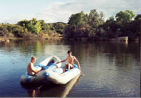 (Photo) Joe and Mark playing with their dingies
Mark, Norm and I set off at about 11:00 in the morning of 4 July 2003 heading for Shumbashaba lodge. It was a lovely sunny day and we were all in good spirits. Mark drove out (Mark has his learner driver’s license) while Norm and I sat back and enjoyed the journey, until we got to the Fort Usher road which was not so enjoyable because of what seemed to be a continuous mining process along the whole stretch of the road, for Mark was continually dodging craters.
We finally arrived at the lodge. Phew what a trip! We decided to spend the rest of the day playing on the dam in inflatable canoes. I continually rammed Mark as he tried to collect weeds for his fish tank. Every effort was made to stop the annoying droplets coming into contact with the skin for the water was unbearably cold. When we had covered the whole area of the dam (which was not very much) we decided to carry our canoes to the other dam which was a little way up stream. We did so and there Mark and I continued to look for weeds. After a while when the sun was getting low, we abandoned our canoes and went to see an old dilapidated house which Norm has his eyes on. It is situated just above the dam on a little kopje. It is a nice place for a house but not a very nice house. We then went back down to the dam where we loaded the boats onto Norm’s trailer and headed back to the lodge.
Back at the lodge I prepared supper which was spaghetti and sauce. We had to cook on an old wood burning stove which was nice for a change. On finishing our meal we cleared up and made coffee which we had round the fire. By now feeling quite tired we all went to bed in Dassie lodge, the front wall being one huge glass window permitting an amazing view across the valley from one’s bed. We slept on loose mattresses on the floor as the beds had been prepared for guests coming the next day.
We woke up to a spectacular sun rise. The sun was a bright red as it rose, it then ascended into a cloud and reappeared on top of the cloud. It seemed as if the sun rose twice. We got up and packed our sleeping bags away. Norm and I headed off to have breakfast while Mark remained packing. When Mark eventually joined us, we had oats porridge. Dr Reeler who was also staying at the lodge joined us for breakfast. We decided that we would only go for a walk, not a proper hike. Well in the end our walk turned out to be more of a hike than a stroll. We went down to the stables where someone was going to meet us and take us to see some cave paintings. When we got there we found that the person wasn’t there. We then found some one else who said he could take us to our missing guide’s house. After quite a long walk we arrived at his house only to find that he was at his mother’s house, so we headed off to his mother’s house which fortunately was not too far away.
We found him there and started on our journey to Kudali mountain where the cave was. This was quite a considerable distance away, but it was a pleasant walk. The cave which is used as a place to hold rain making ceremonies was blackened by fire, soot and graffiti from the war. The original paintings were hardly visible. While we were in the cave Mark disappeared into a narrow crevice to explore. After a while we called for him, but there was no answer. We continued to look at more cave paintings else where, thinking that he would return. Eventually he did. We told him that we had been calling for him, and he said that he had been calling us as he had found a number of broken grain bins which he wanted to show us. Unfortunately neither party heard the other calling.
He told us that there were other caves on the other side of the rock and suggested that we all go and see them. I went the way Mark had gone through the crevice while the others went round the rock. On the other side there were grain bins and more paintings which we looked at. Then we decided that it was time to head back to the lodge. From where we were we could see Shumbashaba. It was a long way away. We took our friend back to his mother’s home and from there we went on alone. When we got back we had lunch and a little snooze on the rock. Dr Reeler took our blood pressure which was fine. By now it was getting late and we had to hurry back to town because Norm had to be in church to read a lesson. We managed to do the journey in record time. We all had a great time. Thanks to Norm.
Joe
-----------------------------------
WILLIAM ARNOLD CARNEGIE ASSEGAI COMPETETION 2003
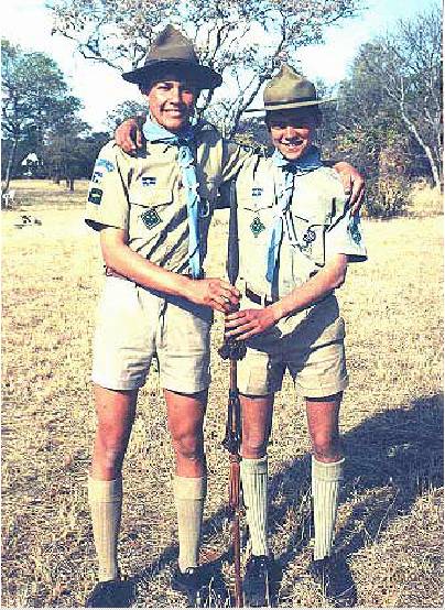 (Photo) Paul and Mark with the coveted Assegai Trophy
It was a brilliant, fresh late winters morning of Saturday 9 August when the 1st Bulawayo Pioneers’, two sole competitors, Paul Carlsson and Mark Perry set off to compete in our second Provincial Assegai Competition event. We left very reluctantly and with a burning feeling that we had left something behind, and as we traveled the long way round to the back of Hillside Dams we remembered various things we had overlooked.
We arrived to an almost empty Jamborally site, at about a quarter to ten, the only others being a young patrol from the 66th Bulawayo Troop. We had a bit of a dispute because we spotted a site which they fancied, but we got it and ended up with one of the best camp sites under a beautiful Peltophorum Africanum tree. We started clearing the thick grass before parade (Which was late as usual) where we received our spare time activities (STA’s) and our timetable. After Opening Parade we started work on the camp site, only to realise that we had forgotten a whole host of critical things. So I soon ran home past the dams with a mammoth list of forgotten items which I hastily packed into the truck before leaving a second time with another truckload full of useful equipment.
When I returned I was pleased to see the campsite looking good, with a tent pitched and a nice gate in the neatly roped off area, and I joined in by raking all the hay out of the way.
After a quick easy lunch, bases started. Our first one was pioneering with a block and tackle; others included first aid, entertainment, road safety rules, HIV awareness, etc., By the end of the afternoon we had completed all the bases except for two (one which never materialized). We then had supper and did a few more STA’s before going to the campfire which was supposed to be a low noise one but it ended up a bit rowdy. One of the activities there was an impromptu speech which I did. After that we had an exhilarating run through the dark and dangerous dams to have a hot shower at home. We found no one at home and had to get into the house, but we surprised my parents when we arrived, and showered. Back in camp when we were quite sure that all our trunks were securely locked up, we went to bed in our tent and had a reasonable nights sleep, just a rather cold one.
We woke early the next morning and reluctantly crawled out of bed, bundling ourselves ups warmly before setting about checking our ingenious security system (one of the STA’s) which involved a trip - wire and a bell. Soon we tucked into a delicious breakfast of oats and coffee with our guest Bekezela (one of the examiners) before doing more STA’s and developing the campsite, perfecting our security bell. The last base was backwoods cooking at lunch time, followed by uniform, campsite and STA inspection. We were convinced the 86th Troop was beating us.
After breaking camp, clearing our site and a final site inspection was parade, when we were sure 86th was going to win. As the results were read out, tension and expectations rose high, and we could not believe our ears when we heard that we had come first. I felt absolutely ecstatic as I received the Assegai trophy for the first time, two of us against full proficient patrols of six. We could not help feeling a little sorry because we had told 86th that they would win yet we beat them by about 150 points out of a total of 750 of which we gained roughly 590.
After our victory photos, we changed, packed up and waited for our lift. We were in a euphoric state when my Dad arrived and we showed him the glorious Assegai trophy. The Assegai, we were told, was a genuine Matabele warrior stabbing Assegai, now the converted Provincial trophy for our major competition of the year. I would like to say that I was pleasantly surprised and impressed by the organization of the Competition , as I had expected chaos. I am also glad we participated, as we not only enjoyed ourselves and learned a lot, but we even walked away with the prize. I would also like to thank and congratulate my gallant fellow victor Paul, and a special thanks to my Mum and Norm who constantly encouraged us as rightly so, to take part in this competition. Without them we would never had entered. Thank you Mom, Norm and Paul.
Mark Perry
Patrol Leader
OUR NEIGHBORHOOD
 (Photo) Ald. Colin Lumsden discusses national and local government structures with ( l to r) Mark, Jonathan, Paul and
Joe, dealing with their Civics badge requirements.
In undertaking their Advanced Scout Badge the Scouts are required to pass the Civics Proficiency Badge and for
one of the sections they are required to write about their neighborhood. In doing this section, the Scouts found the
project very informative and decided that it would make an interesting article for our magazine. Naturally their
articles contained more or less the same information, so for the following article, a section from each Scout’s
research, has been used. Our Neighborhood includes all the suburbs on the east side of Bulawayo.
(Photo) Ald. Colin Lumsden discusses national and local government structures with ( l to r) Mark, Jonathan, Paul and
Joe, dealing with their Civics badge requirements.
In undertaking their Advanced Scout Badge the Scouts are required to pass the Civics Proficiency Badge and for
one of the sections they are required to write about their neighborhood. In doing this section, the Scouts found the
project very informative and decided that it would make an interesting article for our magazine. Naturally their
articles contained more or less the same information, so for the following article, a section from each Scout’s
research, has been used. Our Neighborhood includes all the suburbs on the east side of Bulawayo.Mark starts our story some 100 000 years ago. Evidence of habitation of our area exists of the Hope Fountain culture, early stone age, of about 100000 years ago and moving forward to the middle and late stone age, covering a large area around Hillside and out to where Hope Fountain is now located. Much more recently people of whom we are more familiar with, were the Bushmen or Khoisan people. Evidence of their presence are their rock art and artifacts in caves, one of which is in my yard. These are in the region of three to four thousand years old. After the Bushmen, King Lobengula the second King of the Ndebele had his kraal at what is now known as Old Bulawayo some twenty-five kilometers south of present day Bulawayo. This, his first capital was established in 1870 and he named it “Ko - Bulawayo” which means “the place of killing of the spirit” for there was division amongst the Ndebele people when he was chosen to succeed his father, King Mzilikazi. Lobengula had to move his capital, owing to insufficient water for his people. So he chose a place further North on the banks of the Matsheumhlope river, where present day State House is situated. His herb gardens were located in the present day suburb of Hillside on the banks of the Matsheumhlope river, close to my house.
Jonathan tells us about the establishment of modern day Bulawayo Bulawayo was established as a modern settlement in 1893 with the arrival of the European settlers. A year later in 1894 Dr. Jameson declared Bulawayo a town . In 1896 during the first native rebellion the white settlers gathered for safety at the Market square and to supply water for the people laagered there a well was sunk, which is still in existence in front of the City Hall (which replaced the Market Square buildings) and now supplies water to the ornamental fountain in the City Hall gardens.
Water supplies for early Bulawayo town were obtained from private wells and the Matsheumhlope river which runs through the town. However as the Town grew in size a bigger supply was needed and so in 1897 a private water company was formed and the Hillside Dams were constructed on the Matshemumhlope River. The dams no longer supply water to the city but form part of a recreation park for residents.
The suburb of Hillside was one of the first suburbs outside of the town area to be served by a sewer system and to have street lighting. Many houses however, especially in the very rocky terrain of Hillside, rely on septic tanks as the sewerage system would be too costly to put in. The road system of Hillside is of a grid system and the names of the roads are named after places in England. In my suburb of Malindela the streets are named after poets. I live on Keats Crescent.
Joe tells us of the amenities of the area.
There are many churches in Bulawayo east with the oldest being the Anglican, the Church of the Ascension which was built in 1952. The Catholic Church in Hillside was built in the early 1960’s The suburbs are served by the Hillside Telephone exchange centre. There are many schools in the area. The Hillside police station serves the whole of Bulawayo East and beyond. In our area there are a number of Scout Troops, some connected with the schools and three, the 1st Pioneers, 8th Hillside and the 20th Famona being the only independent open Troops. The Bulawayo Fire Brigade has its Headquarters in Famona, The Mater Dei, United Bulawayo Hospitals and a new private Hospital are all located in the area. A number of modern shopping centres stock just about everything we need from groceries to hardware. The Bulawayo Bowling Club located next to the Centenary Park close to town was established in 1899. It’s first benefactor was Mr. Cecil John Rhodes who presented a cheque for Ł50.00, a copy of which is on display in the club house.
Paul rounds off with the following contribution.
In my neighborhood are located the homes of many of Bulawayo’s more noteworthy citizens both of the past and of the present. Business people such as the late Messrs. Issels and Thomas Meikle had their homes located in Hillside. Mr. Meikle’s grave is located at the Mabukuwene Nature Reserve in Burnside, where we hold our weekly meetings. There are many other unmarked graves, some hundreds of years old, dotted around our neighborhood which are usually found when digging foundations for houses or planting trees. The well known writers, Mr. John Epple and Mr. Keith Meadows live near Mark. A former Mayor of Bulawayo, Mr. Holdengarde built one of the two castles to be found in Bulawayo. Formally the Holdengarde Castle now renamed The Nesbit Castle is in the suburb of Hillside. The Rev. Robert Moffat’s camp site is in Hillside in the Avenue named after him it is near the Hillside Dams. The old site is fenced off and is in a private garden.
Of interest to the sporting community, the Bulawayo Golf Course was opened in 1898 close to the city centre. The horse race track at Ascot was also established in the late 1890’s. The Zimbabwe International Trade Fair is held in Bulawayo, the site being on the verge of the city centre and bordered by the Matsheumhlope River.
-----------------------------------
SAUSAGE SIZZLE
On 25 July 2003 it was once again time for our termly sausage sizzle. It was Joe’s turn to do the lifts and because he only has a small Karmen Ghia they had to do two trips. When we were all at Mabukuwene we lost no time in starting a fire to braai our meat on. Collecting dry aloe leaves from the bush to use as kindling and then, when the fire was burning brightly, we sat and waited for the fire to burn down.
After what seemed an age the fire was finally ready and we got down to what we had to do - the experience really showing through as Paul deftly handled his boerwors, turning it from one side to another, and browning it to perfection. Finally when our sausages were cooked we got the opportunity to eat our masterpieces. It was great to sit down, and relax, talking to your friends over good food. Before we knew it was all over as Mr. Rose had arrived to take us home, so we quickly had to pack up and close. We all bundled into the Karmen Ghia and Joe, Mark and Paul squashed into the back, while I had the privilege of stretching my legs out in the front.
Thanks to everyone for a good evening.
Gumbee
-----------------------------------
Page 6
THE MINI EXPEDITION TO MARULA 11-13 AUGUST 2003
 (Photo) “Miss Piggy”, Marula District
Norm, Joe, Mark, Gumbee and myself left Bulawayo at around 10.00 in the morning. Joe and Mark had made quite a loud sound system being able to be heard clearly above the noisy engine of the landy. We listened to music the whole way up to until the gravel road turn off, when we switched to tape and listened to Black Adder which was absolutely hilarious.
We arrived at the Viljoen’s farm, Beaconsfield just before lunch. After unpacking the Landy and getting acquainted with the place we sat down to an enjoyable lunch. We then decided to go to Shashani Dam and do some fishing. On the way to the dam Norm pointed out a rock formation that looked like a pig - Miss. Piggy of the Muppets Show.
On arriving at the dam we quickly rigged up our rods. Joe was the first to cast into the dam and on his first cast he caught a fish! Joe’s catch filled us with excitement and made us think the fishing was quite good. Gumbee and I soon caught some fish as well. After taking photos of our catch we went back to the Viljoen’s farm for dinner and, yes, fresh fish fillets.
The next morning we woke up to a crisp and clear day with a gentle breeze blowing through the house. After having a wonderful breakfast we went and explored the Marula area. We went to Bill Taylor’s farm where we visited the, now ruined, Tjimali Mission. (Read more in Norm’s article). Bill was using the bricks from the mission to develop his farm. We then went back to Shashani dam where we again caught fish. We then went back to the Viljoen’s farm for dinner. We were all quite tired and so went to bed early.
+ + +
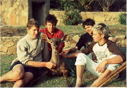 (Photo) l to r: Jonathan, Paul, Mark and Joe with “Sally” our little Kudu
 I woke the next morning to see a baby Kudu being chased around the farm dam. After watching the kudu for a while we all went to the young kudu’s aid. Norm went into the dam and picked up the kudu, which was extremely heavy, and damaged his back. Gumbee, Mark, Joe and myself picked up the kudu and took it back up to the cottage where we dried and comforted it. While I was caring for it, it jumped up and ran back down into the dam. We soon recaptured the frightened animal and took it to the bush where we set it free. It didn’t move and just lay on the ground.
We went back to the house and packed everything into the Landy and prepared to leave. On our way out of the farm we saw the kudu get up and run off into the bush. From the farm we went to Mangwe Dam where Gumbee and I jumped off a water tower into the water, about ten metres below. We then visited Fort Mangwe and the ruins of John Lee’s house and the pre-pioneer cemetary. We also saw the Mangwe Pass memorial where there were footprints from the oxen and the voortrekker in concrete. The wagon tracks were also preserved in concrete.
We then left for Kezi. The roads were very stony and bumpy. The stones punctured a tube so we had to stop and put on the spare wheel. The rest of the way was quite uneventful so we all just relaxed and listened to music the whole way back to Gordon Park where we had a great dinner. It was a really great trip. Thanks Norm.
Paul.
Page 7
-----------------------------------
TJIMALI MISSION
Tjimali Mission was established in 1907 by Mr. Whiteside of the London Missionary Society, on a farm that had recently been acquired by the Society in the heart of Ematotjeni, Matopos, (so the Matabele spoke of the district). Ichabod was the name given to it by some despairing settler, but the missionaries, knowing that the glory had not departed, resorted to the original name of Tjimali. The farm was well situated from a health point of view, on the Semokwe river, well watered, of most excellent soil and about sixteen miles (twenty five kilometres) from the Plumtree -Bulawayo railway line. The mission buildings themselves were situated near Tjimali hill, on the top of the escarpment overlooking the Semokwe river.
There were very many people already resident in the area and many more were coming, both of the Matabele and of the Makalanga. In 1909 three indunas and their following came from their former areas because of the demand by their landlords for increased rent, deciding to settle on the mission farm.
As a certain traveller in the South Sea Islands once said, some missionary societies appeared to coddle their missionaries, but the authorities of the London Missionary Society seemed to take their reverend brethren by a certain part of their apparel and drop them in some wild spot and bid them do as best they could. In some such way Mr. Whiteside was dropped at Tjimali. He could get advice and sympathy from his brother missionaries at lnyati and Hope Fountain, but they were far too busy to do more. Like all his predecessors in Matabeleland, he was cast upon his own resources.
One of the Hope Fountain church members went with him to teach and help till he should have picked up some acquaintance with the language. Almost at once he found himself needing five native teachers. In 1908 he obtained them, and now they are located at as many out-stations. From the first, his congregations numbered well into a hundred, and they steadily increased.
Tjimali Mission was closed sometime in the 1930’s and today only the ruins of what must have been a beautifully build mission station - for it was built of burnt bricks and had wooden strip floors remain. Sadly, this long deserted building, along with an equally substantially constructed stables that have stood for almost one hundred years, is being demolished and the bricks used for new dwellings being constructed on the farm.
Acknowledgement: W A Elliot: Gold from the Quartz.
-----------------------------------
Page 8
THE MANGWE PASS
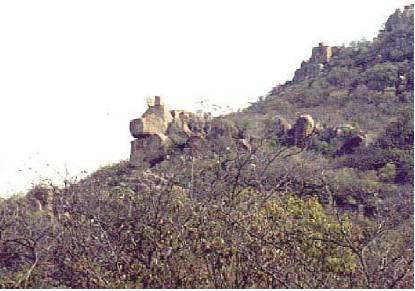
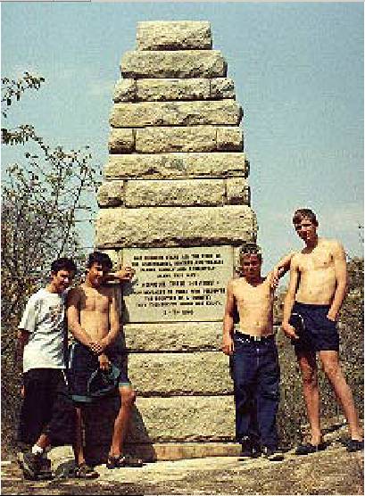 (Photo) The Troop at the Mangwe Pass Memorial
THE western end of the Matopos is the least known to the public and yet is by no means the least interesting. The scenery there is striking and has an individuality of its own, being far more open and spacious.
There, fifty-eight miles from Bulawayo and fifteen from Marula is the Mangwe Pass. In the early days the only line of communication between Matabeleland and the rest of Southern Africa lay though this pass, then known as Tiger Poort. Five miles from the pass and at no great distance from the Mangwe Police Camp, the old fort, the ruins of Lee’s house and the pioneer graveyard may still be seen.
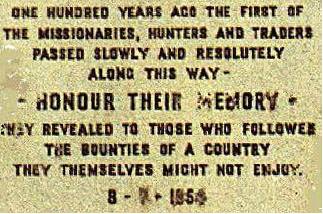
At the pass in 1954 a striking memorial to the pre-.pioneers was erected by the people of the district. It is in a very beautiful setting, to which it is admirably adapted.
It was unveiled on the 18th July, 1954 (the actual date of the arrival of the first wagon was the 8th July, 1854). The service was conducted by the Reverend P. S. King of the London Missionary Society, a tribute to the part that had been played in the early settlement by that society. It was most impressive and was attended by upwards of 700 people, including many descendants of the pioneers and some who knew the road in the days before the Occupation, such as Mrs. Lovemore and Sir Eric Thomas. Appropriately enough, some klipspringer and a great eagle solemnly watched the proceedings from the rocks above.
Sir Robert Tredgold gave the following address:
“First of all I should like to say a word of appreciation of the BulalimaMangwe Road Council and all those who have associated themselves with the erection of this very beautiful and fitting memorial. They have shown imagination and a sense of history, and we, the descendants of those honoured and the public of the colony as a whole, are deeply in their debt. It is always invidious upon such an occasion to mention names, but I cannot refrain from making special reference to the part that has been played by Mr. Tapson and Mr. Rosenfels. They have been the moving spirits in the whole undertaking and Mr. Rosenfels has virtually erected the memorial with his own hands. It seems to me that the whole undertaking, from its conception to the wording of the inscription on the monument, bears the mark of inspiration.
“There is another point I should like to make at the outset. In the course of what I have to say I shall mention certain names. I have chosen these because they represent a type or because they were associated with some incident of particular interest. There will be many present who feel that other names are equally worthy of mention. This I most fully concede. It is obviously impossible to mention all. One of the things I like most about the memorial is that there has been no attempt to set out names. As in the case of the grave of the Unknown Warrior, it commemorates the known and the unknown, the famous and those who missed the accident of fame. Each can name in his own heart the name that seems to him most worthy.
“There are some who hold that in this country was the very cradle of the human race. Be this as it may, these old hills have looked down upon many strange and momentous events during the aeons they have kept their watch and ward over our land. This we do know, that, ever since the great wave of Bantu migration ceased to flow southwards and began to ebb to the north, the passes of the hills have stood as the portals of the interior. The fear of the thirst-lands to the east and to the west has diverted men and compelled them to travel this way. Makalanga and Marozwe, Amaswazi and Amandebele have surged about their foothills. Perhaps now and then amongst them may have been seen the solitary, valiant figure of a Portuguese Father only to be swept away in the great movements about him.
“Then, just over a hundred years ago, for the first time the shuffle of naked feet and the thud of hooves gave place to the rumble of wagons. The white man had arrived and a new era had begun. The wagons passed round the rock to my right for the passage on the left was not then open. No doubt they scored on the rock itself the first of the marks which have, in the course of time, become permanent. There were two white men with the wagons, Robert Moffat, the veteran missionary, and Sam Edwards, the son of his old colleague, cheerful and plucky, the prototype of the trader of whom I shall subsequently speak. They had left Kuruman seven weeks before, which was good travelling for those days.
“And here I must pause to say a word about Kuruman. Kuruman is now a sleepy backwater of the Cape Province, but, for the better part of the last century, it stood to the hinterland in the same relation that a single seaport stands to a seabound land. Most of the great African travellers passed that way. There they felt the last touch of civilisation and gracious living and there they received fresh provisions and wise and experienced guidance. There they returned very often sick in body and battered in mind to be nursed back to health and sanity. This country owes a debt to Kuruman which it has been tardy in acknowledging.
Page 9
“But to return to the travellers. They had had an arduous journey. They had suffered great hardship from thirst and had been harried by wild animals. The greater part of the journey had lain through trackless wilderness. For ten days before reaching the pass, they had seen no human being nor any sign of habitation. One feature of their journals illustrates vividly the difficulties with which they were faced, the constant preoccupation with the loss of the oxen. The carelessness of a herdboy, ordinarily a matter of minor inconvenience, was to them a matter of life and death. More than once there had been an anxious search for the oxen which, had it failed, might have meant that the whole expedition perished miserably. There was one sad little casualty, and near this spot is the grave of Rhodesia’s pioneer kitten. The measure that they felt this slight loss was the measure of their loneliness.
“So they passed on to renew that strange friendship between the uncompromising missionary and the fierce old king, Umzilikazi, which had such far-reaching consequences in opening up this country.
“Three years later Robert Moffat came again. This time he was alone except for his faithful Bechuana servants. He was over sixty and feeling the effects of the strenuous life he had led. His heart was troubling him and he was ill in other ways, but he felt it was necessary to come to prepare the way for the mission he hoped to establish and so he came.
“In 1859 he came for the third and last time. With him he brought the men who were to establish the first white settlement in Matabeleland. They were his son, John Smith Moffat, Thomas Morgan Thomas and William Sykes. Each was to play a major part in the history of the succeeding years. There were two women with them, Mrs. J. S. Moffat and Mrs. Thomas. Our modern misses are apt to scoff at their Victorian grandmothers. When they do so, I wonder if they think of these and such as they, for they were by no means unique. A few months before, they had seen nothing more expansive than the South Downs or more dangerous than the new-fangled steam engine. But here they were in the heart of Africa making light of hardship and danger. The one with a queer mixture of courage and nostalgia called her wagon ‘The Pavilion’ after the edifice which adorned, or some might say, disfigured, her native Brighton. The other seems to have been of a singularly sweet and gentle nature, oddly unfitted for the stern task she had been set. But she had not long to endure. Within three years she had died. Before she was twenty three she had passed on and taken her baby with her - the first martyrs to civilisation in Matabeleland. And now they were to witness one of the strangest scenes that even the hills had seen in their long vigil. Lung sickness had broken out amongst the cattle and they were sent back lest they infect the Matabele herds.
Partly for practical reasons and partly in compliment to the missionary, Umzilikazi sent an impi to drag the wagons from here to near where Bulawayo now stands. They were pulled by a yelling crowd of savages. It is easy to imagine the feelings of the women surrounded all day by these fierce warriors and by night watching the fires glisten on their almost naked bodies as they ate the oxen provided for their food. Thus began the mission at Inyati.
“The first of the hunters had already preceded them and Henry Hartley was following the elephant trail in the district that now bears his name. It was he who was to spread the whisper of gold that had such fateful consequences. He came here frequently and for long periods, but he never settled in the country.
Page 10
“The first hunter to settle was John Lee, the founder of this district. He was a colourful personality. He was the son of a captain in the Royal Navy who had married an Afrikaner woman, a niece of President Kruger’s. Although he was not much over thirty when he came to this country, he was already a veteran of four of the old Border wars of the Cape Colony. He soon established himself in the confidence of Umzilikazi. He was appointed his agent, the first Customs and Immigration official of this land. He was given a tract of land just below the pass, as much as could be covered by a horse ridden for an hour and a half in each direction. Unfortunately, the old king had not specified the speed at which the horse was to travel and the survey which was carried out by Carel Lee resolved itself into a tussle between him and the attendant indunas. Nevertheless, Carel managed to acquire something over 200 square miles. There John Lee built a permanent house which became the centre for hunters in the rainy season. Many well-known travellers stayed in the vicinity including the artist explorer, Baines. Here he painted a number of pictures including, oddly enough, the one which some of you may know, showing the departure of his expedition from Pietermaritzburg. Lee’s land was finally confiscated after the Occupation because he refused to cooperate against the people whom he regarded as his friends and benefactors - an incident which reflects more honour upon him than upon the Administration.
“Robert Moffat and Sam Edwards had been single-minded men, engrossed in their own purposes, but they had opened the door to a trickle of humanity which was to become a flood and change the whole face of Central Africa.
“Other representatives of the London Missionary Society came Thomson and Elliott, Helm and Carnegie. There came too the Catholic Fathers, including that appealing figure, Father Kroot, who was so soon to die, and Father Prestage, who left so deep a mark upon this district. Besides the missionaries there were the hunters such as Viljoen, Jacobs and Greeft, Finaughty and Woods; the greatest of them all, Frederick Courteney Selous, the typical Englishman, reserved, steadfast, self-sufficient, and his staunch and loyal friend, van Rooyen, typifying all that was best in the Afrikaner. I often think that if van Rooyen had had the pen of a ready writer, he would have attained to a fame equal to that of Selous, for he was not only a mighty hunter, but a fine naturalist and an outstanding character.
“Then there were the traders such as Westbeach and that grand old man, ‘Matabele’ Wilson who is still alive and as clear-headed as the day he came here. There were some who came for the sheer love of adventure. The most remarkable of these was the artist-naturalist, Frank Oates. He was one of those bright spirits that seem only to be sojourners here, bound for a bourne beyond our knowing. One wonders if there beat in his veins the same blood as that of the ‘very gallant gentleman’ who went out into the snow to give his comrades a chance of life. He was to die on the return journey and he lies buried away to the west, near the headwaters of the Shashi. There is a moving story of his faithful pointer who had accompanied him on all his travels. When the wagons reached the Tati, Rail was missing and was eventually traced back to where he was keeping his lonely watch by his master’s grave.
“We may pass over the undignified scramble of the concession hunters during the ensuing years. It is sufficient to say that many of them were actuated by patriotic rather than by selfish motives. But, during this period, a subtle change had taken place in the character of those that used the pass. Amongst them were young people who referred to the northward journey as ‘going home’. A generation had arisen that claimed their place in this country by birthright.
“The great events of 1890 moved away to the east and left the pass undisturbed. But, in 1893, the Matabele War brought the tramp of armed men to the pass and that strange thunder of horse-drawn guns, which those who heard it will never forget. Gould-Adams’ Column played a part of great strategic importance although it saw little fighting. It contained a number of impis which might otherwise have opposed the march of the Salisbury and Victoria columns. There was, however, one desperate little battle below the hills, in which Selous was wounded and had a very narrow escape. The column approached the pass with great misgiving, but, away at Bulawayo, events had moved rapidly and the impis had withdrawn to join their king in his flight to the north. With this column came another Moffat who, in the passage of time, was to become the Prime Minister of this colony.
“Three years later the pass was again the scene of warlike operations. The rebellion had broken out and the pass was a link in the only direct line of communication with the outside world. Forts were built to protect it. The old names recur: van Rooyen in command, Hans Lee and Greeft with him. Van Rooyen was highly respected by the natives and it was mainly due to his influence and that of Father Prestage that those in the locality did not join in the rebellion. Nevertheless, the pass would have been difficult to hold had it not been for the strange command of the Mlimo that it should be left open as a way of withdrawal for the fleeing white people. Instead it became a way of reinforcement. The Matabele Relief Force advanced through the pass under the command of that greathearted soldier who afterwards became Field Marshal Lord Plumer. His Chief of Staff lifted up his eyes to the hills and received an inspiration that, years later, was to burgeon forth into the worldwide Boy Scout movement.
“But, away to the west, the railway was creeping northwards. Independent of surface water, it outflanked the hills. The old order had changed yielding place to new. The machine age had arrived in Matabeleland. The pass was left to quietude and to its memories.
Page 11
“And now we are gathered to give honour where honour is due. I think it may be claimed with all modesty that Rhodesia has reason to be proud of her pre-pioneers. “We, who live in the age of amenities, may well pause to wonder what it was that drove them forth into the wilderness to accept privation, suffering and the shadow of death as their daily lot. What was the faith that was in them, whether it was articulate or inarticulate, understood or only dimly comprehended.
“In a way, the missionaries are the most easy to understand. They were supported and sustained by an unfaltering faith in Him upon Whose work they laboured. They were content to seek no other reward save that of knowing that they did His will.
“But the traders and hunters were no ordinary fortune seekers. The reward to be won, or even to be imagined, was in no way proportionate to the risk and hardship they had to face. Even the prospectors for gold, who played for higher stakes and consequently had a more reckless streak in their make-up, were purged in the same fires of trial and endurance. Beyond a doubt, all were inspired by something deeper than the mere desire for gain. Let us call it the spirit of adventure and leave it at that. At least it was something that lifted them above the ruck and placed them a little nearer to the angels. No doubt there were inglorious exceptions but, in the main, they were men of exceptional character. Their courage was manifest. They were straightforward and upright in their dealing. Their standard of conduct was high. There is evidence of this in their relations with the missionaries, for they were welcomed into the mission homes and were regarded as friends and allies.
“Some of us remember the survivors with their patriarchal beards, grave faces and quiet eyes. There are some indeed present today who travelled this road with them. We know that, though they may not have found fortune or fame, they had found something greater. We can bear witness that these were men, take them for all in all, we shall not look upon their like again.
“Yes, we have travelled a long way since those days. We have seen advancement beyond their imagining. We have seen beyond the sound barrier and inside the atom. We have seen through space to what may well be the limits of our own universe, but I wonder if we have seen deeper into the heart of things than these old adventurers. Excellent courage our fathers bore -Excellent heart had our fathers of old.
 None too learned, but nobly bold
Into the fight went our fathers of old.
If it be certain, as Galen says -
And sage Hippocrates holds as much -
‘That those afflicted by doubts and dismays
Are mightily helped by a dead man’s touch,’
Then, be good to us, stars above !
Then, be good to us, herbs below
We are afflicted by what we can prove,
We are distracted by what we know -So
- ah, so !
Down from your heaven or up from your mould,
Send us the hearts of our fathers of old ! ”
None too learned, but nobly bold
Into the fight went our fathers of old.
If it be certain, as Galen says -
And sage Hippocrates holds as much -
‘That those afflicted by doubts and dismays
Are mightily helped by a dead man’s touch,’
Then, be good to us, stars above !
Then, be good to us, herbs below
We are afflicted by what we can prove,
We are distracted by what we know -So
- ah, so !
Down from your heaven or up from your mould,
Send us the hearts of our fathers of old ! ”SIR ROBERT TREDGOLD: A Revised Edition of “A Guide to the Matopos” by Dr E A Nobbs;
Federal Department of Printing & Stationery 1956
-----------------------------------
Page 12
THE MATOPOS EIGHTY KILOMETRE CHALLENGE HIKE : 11 TO 13 MAY 2003
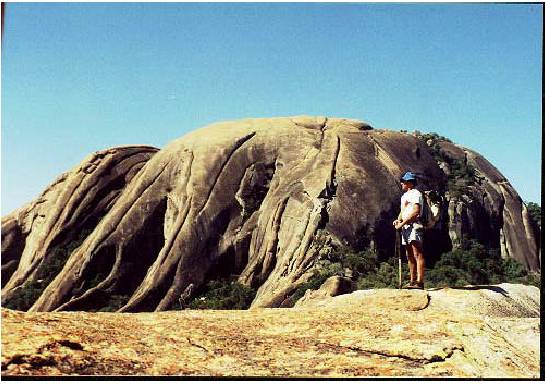
(Photo) High on the saddle of Silozwi with the peak towering above
The challenge was quite simple; “to undertake a hike on a straight line across the Matopos from one defined point to another, the distance to be at least eighty kilometres (fifty miles)” The fifty miles came about from the now defunct Bata Toughee 50 mile Hike, a national Scout hike competition which was held in 1965 and of which, I as a Senior Scout was the winner. Now that I had matured somewhat, in years if nothing else, something more challenging than the Bata hike for teenagers was in order and as our Scouts hike on a regular basis, I didn’t foresee any problems for them to undertake such a challenge.
As I had already undertaken a solo straight line hike of 37 kilometres in 1980 — a rather daring thing to do as Zimbabwe had only just gained independence after a bitter 10 year bush war and tensions were still high — and that to my knowledge no other person had done such a hike; it was left to my own imagination as to the area in which the hike was to be undertaken. To obtain the best of the challenge, I decided to do a “cross — grain” hike and as the main drainage of the Matopos is from North to South, the hike would have to be East to West or vice versa. Secondly, it would have to be on the Southern fringe of the Matopos before the hills of the escarpment gave way to the relatively flat undulating dry region of the middle veld of the Gwanda/Kezi areas. And so I chose my two reference points — the Whovi River / Kezi road bridge, elevation 1100 metres near Natisa growth point on the Western side of the Matopos and Mawabeni growth point, elevation 1120 metres on the Eastern side.
Looking at the line it was obvious that the route passed over the highest of dwalas / Kopjies, notably Mount Silozwi, a climb of 340 metres from the valley floor, as well as numerous other imposing dwalas with correspondingly the deepest of valleys, which in numerous instances were akin to gorges with their steep sides, the rivers at their wettest and the Matopos “jungle” at its thickest. Baden-Powell in 1933 described the Matopos in these words: “I suppose there is no more damnable country in the world for Scouting in than the Matopos”.
Having defined the straight line, I then drew two parallel lines five hundred metres on either side of the line linking the two reference points so forming a one kilometre wide corridor in which to hike. The line was sixty kilometres “as the crow flies” and when a rough cross section was drawn, the route came to an estimated seventy— five kilometres. Next a time limit was needed, so I decided on four days, this being derived from the assumption that twenty kilometres a day was possible. The last consideration was the date. As it was to be a four day hike it would need to be during the school holidays so that our Scouts could take part, accordingly the April school holidays were chosen, for the weather should be reasonable, nice warm days with warm to mild evenings and sufficient water in the rivers to sustain us, although we had suffered a drought year, any later in the year the availability of water would definitely pose a problem.
The April school holidays came and with them a realisation that the Scouts had too many pressing activities that had priority over the hike, so the idea of a Troop hike had to be abandoned. I, however, had psyched myself up to such an extent that I decided to go ahead with the hike and so the week the schools opened and there was no question of the Scouts joining me on the hike. I ventured forth an my epic solo hike, which now, being an my own I planned on doing in three days instead of four.
Late in the afternoon of Saturday 11 May and after everyone who had attended the monthly church service at Gordon Park had departed, I too left Gordon Park and headed for my starting point at the Whovi River / Kezi road bridge. It was 17.45 hours when Mrs. Moloney who had kindly agreed to drive me to my starting point, left me standing by the side of the road, with my ruck sack and thumb stick as my companions, taking my Landrover, Inguluvane, back to town. As the light was fading I took my first bearing of 67 0 magnetic. The only bearing, for it was to remain the same for the entire hike and headed off, but not as depicted in the movies, into the sunset. Fortunately it was a near full moon that lit up the heavens and which enabled me to hike for three kilometres, to a point I could clearly pinpoint on the map. At this point was a village and after introducing myself and obtaining permission to camp in the vicinity under a tree, I made a mug of coffee, ate my prepared meal of roast chicken and trimmings before rolling out my sleeping bag and retiring for the night.
Page 13
I awoke to a fantastic morning sky just before 06: 00 hours and lay in my sleeping bag trembling with excitement of the journey that lay ahead. I had decided during the planning of the hike that I would only have a mug of coffee in the mornings so as not to waste too much time, “brunch” at about 11 .00 hours and then dinner at the end of each day’s walk.
Whilst my coffee was on the brew I packed up and then taking out the first map, for I was going to hike across four maps during the hike, I studied it in relation to the ground and chose my route for the next few kilometres. As I was doing this, I was joined by the head of the homestead that I had camped next to. He was in his fifties who worked for an NGO (Non Government Organization) in helping to promote the writing of stories and poetry in schools. We had a long conversation, sharing my coffee with him and gaining much knowledge of conditions in the area. Most importantly for me he told me of various paths to follow in order to get to Silozwi Mountain, all thankfully within my hiking corridor. At 06.30 hours I headed off, soon to be joined by a number of children walking to school as the first part was along a road. Matopos is map reading country and once one knows where one is, the compass is seldom necessary. This together with my knowledge of the terrain, although I had not hiked in this particular area before, enabled me to make good progress. Another advantage was that most of this day’s hike was through communal lands and some through farm land, so I was able to follow paths that zig-zagged within my hiking corridor. I met many people, all very surprised at seeing a lone “Mukiwa” (white man) hiking through the bush. They were all very friendly and many offered me cobs of maize to munch as I hiked. I am sure that they thought I was mad for attempting such a journey especially when asked if I was not afraid of the wild animals and the despised militant war veterans that had recently came into the area to occupy former white owned farms. My reply was that I was not, for my mission was to accomplish a hike challenge and all that what came along with it.
One thing that I had noticed, but which did not strike me as unusual in any way at the time was a particular set of shoe tracks left by a walker somewhere ahead of me and seeming to go in my direction. The shoe pattern was a common one of a locally made pair of shoes, yet there was only one set amongst the others along the paths. More about them latter in my story.
My first major obstacle was Silozwi, which being the highest Kopje in the Matopos measured from valley bottom to top, looked very impressive from my view point. The valley below me was about sixty metres down, then up onto the saddle of Mount Silozwi was another 340 metres. This impressive kopje on the southern edge marks the boundary of the Matopo range.
14
From where I stood, I reconnoitered with my eyes a possible route up the side onto the saddle. The centre line of my hike passed over the saddle just where the crown of the mountain itself met the saddle, with the southern five hundred metre boundary line passing over the very top of the Mountain. It was 10.30 hours when I left my rest place high up on a ridge with just a beautiful peaceful looking valley separating me from the saddle on Silozwi The climb down to the valley floor was quick and relatively easy, then across the valley floor and up onto the saddle. The climb up onto the saddle proved to be very tough going. The tangled mass of vegetation, hidden boulders and deep troughs of leaf mould made the going extremely difficult. Not only was I cut, scratched and abrased when I reached the top of the saddle, right on the centre line of my hike, but my rucksack too had been torn in many places. Incidentally, the rucksack is the same one that I had won in 1965 as the Provincial prize of the Bata Toughee 50 mile hike, and I have been using it for all my hikes ever since. Looking back to my last resting place on the ridge across the valley which was a good deal lower, I wondered why it had taken me over an hour and a half, for it looked so close. The time was now 12.30 hours and I had not yet had my ‘brunch”. After a short rest I continued over the ridge and down to a shady place among the trees at the bottom of the mountain. Here I was surprised to find a small, crystal clear stream which flowed into a rock pool in the river. An ideal place for a well earned lunch, bath and rest. “Brunch” was a simple affair of tomato soup, a bun and two boiled eggs, more than sufficient, for I was not hungry as I was so elated at my good progress. After an hour, I donned my rucksack and headed off for what was to be a really tough afternoon’s hike. This section was a mix of bundu bashing, kopjie climbing and following game trails. The amazing thing though, was when I was in doubt as to which trail to follow, when I did come upon some vestige of a track, I noticed the shoe tracks I had seen earlier in the day, fresh as ever and going in the right direction.
The afternoon’s hike was a real slog, what with the sun now hot and mercilessly beating down on me, all the major rivers I expected to find water in were dry, and the bush was thick. As the sun sank low on the horizon I came to the Toghwana River, which was only about five kilometres from my intended night stop. Here I hesitated and decided that instead of proceeding directly to Lushumbe School, where I intended to camp for the second night, I followed the Toghwana River up stream for about four kilometres to Masiye Camp, a Salvation Army vocational training centre for orphans whose parents had died of Aids. I reached the centre just as night closed in and was lucky to find one of the Officers still working.
The reason for my detour, was to phone Mrs. Moloney to let her know that I was on schedule and that I had not come to any harm along the way. She in turn would phone other people, who had voiced their concern about my solo hike. At least they knew at what point of my hike I had reached should I “go missing”. From my point, it was comforting to know that people were concerned about my welfare, but the hike was something I had to do, something I could not explain to any one. Before continuing I decided to have supper, a chance to buy some cool drinks and a bath in the camp’s laundry basin as the showers had already been locked for the night. From here I followed the road for two and a half kilometres to Lushumbe School, where after making my presence known to the Headmaster, a Mr. Moyo, and receiving permission to camp under a nice shady tree, yes the moon was full, I once again rolled out my sleeping bag and was soon fast asleep. The objective of twenty kilometres straight line map distance had been accomplished - actual distance twenty five grueling kilometres.
Tuesday morning dawned, with the promise of another perfect day. Having woken early to have my coffee, I paid a courtesy call on the Headmaster who was still perplexed as to why I had chosen to sleep under a tree, where wild animals could harm me, instead of accepting his offer of a room in his house. He gave me useful information of where I would find a path to take me over the range of kopjies and then on into the Matopos National Park. The path was not so easy to follow as it was little used and because of the drought the trees were shedding their leaves early. Eventually I lost the path altogether and I literally had to fight my way through dense bush to get to the top of the range.
From here my progress slowed considerably for once in the National Park the grass was so tall it towered over me and there were no trails to follow, or so I thought, for once down in the valley off the ridge, I picked up a trail and low and behold the shoe track was there in the sandy patches of the path. I was really elated at coming upon an old National Park’s landrover track which I knew had existed twenty years before, for I had followed it in “Inguluvane” in 1982. Now I was in familiar territory and made good progress over the range of kopjes and through the valleys I had hiked through over the years.
15
I eventually came to the TuIi river at the exact place where, in March of this year, on one of our monthly Troop hikes, we had waded chest deep for ten metres through the raging torrent of the river caused by cyclone Japhet. Now it was no more than 1.5 metres wide and only just flowing. I decided to stop here for a “brunch”, as it was already 13.00 hours and I was feeling a little “peckish” and quite exhausted. I must admit, I could have had a longer lunch break for I was now beginning to feel the rigours of the hike, muscles were tightening up and the sun was burning hot. Having hiked this section of the route fairly recently, I knew of the path that would take me out of the Park to the communal land where I was to find many paths. I was in the TuIi river gorge and the Tuli River was the boundary between National Park and communal lands. Up and up, the path wound its way to the very edge, if not slightly out of my hike corridor before it turned and led me safely back onto my line of hike. Once on top, the going was easy and I made good time despite my muscles constantly reminding me that they really needed to rest a while.
Mid afternoon saw me on the Dobe School I Gulabahwa road which I followed for about three kilometres before seeking advice from the local people on the most direct path to Silobi Growth Point. I really didn’t have to worry for my shoe pattern showed me the way. It was a very exhausted hiker that arrived at Silobi early evening. I made straight for the bottle store and downed two ice cold cool drinks before facing a barrage of questions from the patrons who could not believe their eyes at my appearance, firstly for appearing out of nowhere at such a late hour and secondly at my rather ragged looks, dirty, unshaven and by now barely able to walk. That night I slept at the rural clinic, on the operating table I think, per kind permission of a rather inebriated clinic male nurse. I had a fine supper of tuna salad, potatoes and peas all washed down with a large mug of coffee. Again my objective of 20km straight line map distance had been accomplished. Actual distance 25km. Total 50km.
On waking up on Wednesday morning I was greeted by a cold drizzle. Just as well I had slept indoors. Off again by 06.30 hours, even before my host had opened his eyes, bless his little cotton socks, I headed off for Mashashasha Falls through familiar territory. The drizzle came and went and as the air was a lot cooler than the previous two days I quite enjoyed the change. Also, after a good nights sleep, my muscles responded eagerly to the fast pace I set myself. I reached and passed the falls in no time and was soon down on the Mtchabezi River where I expected to have to cross the upper reaches of the New Mtchabezi Dam. Fortunately for me, the level of the dam had dropped and so I crossed the river without getting wet.
Surveying the map and looking at the actual terrain, I decided that if there was a path in the vicinity, the area having been cleared of all habitation with the building of the dam, it would most likely follow a small stream running down from the top of the escarpment. Sure enough, not only did I find the path where I expected it but it was a fairly wide track, and coming down the track was a herd of cattle with their herdboys. As there is nothing like local knowledge to assist a stranger to find his way, I asked for directions to Mazhowe Mountain which is a prominent mountain some five kilometres distant. Checking their directions against my map I thought I had it all clearly sown up and proceeded along the path, up and out of the gorge.
At the top of the initial climb I came across a village and vegetable gardens but there was nobody in sight. I checked my map and decided that I had about another half a kilometre to go before I looked for the path that was to take me over an impressive range that loomed up before me. I had no sooner put on my rucksack and started walking when an old man appeared as if from no where and the first thing he said was “I think you are lost.” And so started our conversation and when I told him I was heading for Mozhowe, then Diana’s Pool and finally Mawabeni he smiled and said that I should turn off the path I had intended following and go down into the donga (gully) next to me, where I would find a path that I should follow that would get me over the range of kopjies - Mount Mazenzelo, that loomed over us. He gave very clear and precise directions as to which paths to follow and which to ignore and finally, that I would pass through a “hole in the rock” after which I would find myself on top of Mazhowe Mountain. I thanked him profusely, dropped down into the gully, turned to wave to him, but there was no one there. No sooner was I on the path which by now was damp from the intermittent drizzle when I noticed the shoe tracks in a patch of sand as I crossed the little stream. The old man’s directions were so precise that I did not even have to take out my map, just as well for the drizzle continued with a greater intensity. At long last I went through ‘the hole in the rock” and within a kilometre went over the northern edge of Mazhowe mountain, right on the centre line of the hike. Dropping off the mountain to the valley below was a different story. In the drizzle, barely able to see through my rain washed glasses, I had missed the path and now I found myself on the edge of a steep rock face with the path I intended following, at the bottom.
16
The drizzle stopped and I sat down with my feet tucked up close to my bottom, hands out on either side of me, ruck sack resting on the rock slope behind me and the thong of my thumb stick clenched between my teeth, I set off sliding down the rock face - all of forty metres of hair raising excitement - even going down hill on a roller coaster doesn’t produce the same adrenaline rush as this slide produced. A great sigh of relief when I reached the bottom I can assure you. Shortly afterwards when I had resumed my hike the rain really poured down.
As I had been to Diana’s Pool on many occasions I did not stop but continued past them for another two kilometres before stopping to have another late “brunch”. Not long after having resumed hiking I was joined by an elderly man who was on his way to fetch his cattle. Fortunately he was going my way so we struck up a conversation. When he arrived in the area where his cattle were, he put me on the direct path to Mawabeni. Nearing Mawabeni, I was again assisted in finding the most direct path through the settlement on the Nsezi River which was a river of sand of one hundred metres in width.
I arrived in Mawabeni Growth Point at 17.15 hours, cold, as the temperatures had dropped considerably, and thoroughly exhausted having covered thirty two kilometres for the day. From here I managed to get a lift in a haulage truck on its way to Bulawayo. At Essex filling station, near the city I alighted and phoned Mr. Rose, a parent of one of my Scouts and requested a lift home but not before he had taken me to his home for supper, which I greatly appreciated.
The distance of my hike turned out to be eighty two kilometres and I had done it in three days. I enjoyed every moment of it, despite the change in the weather and painful leg muscles for the following few days. What of the shoe prints that showed me the way from start to finish, especially at times when I was uncertain of which way to go, even in the National Park in an area nobody would normally be? Then, when I was going really slowly because I was tired, the shoe prints came in the opposite direction, towards me, perhaps they were saying “hey hurry up”? And the fact that I did not actually see anyone wearing shoes with that particular pattern, although I know it is a common one. And then the old man who seemed to appear from nowhere and disappeared just as unexpectedly. Perhaps it was another case “ of footprints in the sand ”. Certainly my guardian angel was with me.
Norm.
-----------------------------------
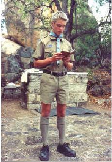
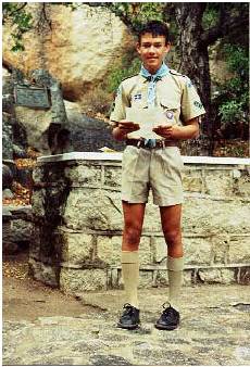 As part of their Advanced Scout Badge tests concerning their Duty to God,
Joe and Paul conduct the June and July Scouts’ Own Services
respectively, in the St. George’s Chapel at Gordon Park.
As part of their Advanced Scout Badge tests concerning their Duty to God,
Joe and Paul conduct the June and July Scouts’ Own Services
respectively, in the St. George’s Chapel at Gordon Park.-----------------------------------
17
1ST BULAWAYO (PIONEER) SCOUT TROOP
TROOP PROGRAMME OF ACTIVITIES
SEPTEMBER to - DECEMBER 2003
SEPTEMBER
5- 6 Monthly hike
9 Schools open
12 Troop meeting : Mabukuwene
14 Gordon Park service: 1200 noon
19 Troop meeting : Mabukuwene
26 Troop meeting : Mabukuwene
27 Provincial Cook-out competition
OCTOBER
3-4 Monthly hike
11-12 Parents’ camp
12 Gordon Park service: 1200 noon
17 Troop meeting : Mabukuwene
18- 19 Jamboree-on-the-air/internet
24 Troop meeting : Mabukuwene
31 Troop meeting: Mabukuwene
NOVEMBER
7-8 Monthly hike
9 Gordon Park service: 1200 noon
14 Troop meeting : Mabukuwene
21 Troop meeting Mabukuwene
28 Troop meeting Mabukuwene Sausage sizzle
DECEMBER
4 Schools close
5- 6 Monthly hike
12 Troop meeting Mabukuwene
14 Gordon Park service 1200 noon
19 Troop meeting : Mabukuwene last meeting of the year
25 Christmas day
Pantomime duty dates to be advised
18
THE CENTENARY PILGRIMAGE
It was natural, indeed inevitable, that the View of the World should become a place of pilgrimage and it has seen many such occasions. But the most memorable was that which marked the climax to the celebration of the centenary of the birth of Rhodes. On the 5th July, 1953, a solemn procession, more than a quarter of a mile in length, wound slowly from the outspan to the grave. At the top of the hill there gathered upwards of 5 000 people. Amongst these were Her Majesty Queen Elizabeth the Queen Mother and Her Royal Highness the Princess Margaret and the Governors of all the three territories, soon to be joined in the Federation. No one who was present will forget it all: the hushed reverence of the great concourse of men and women, against the silence of the eternal hills, the impressive service and the reading of the most appropriate Psalm - the one hundred and twenty-first. But a Press reporter struck the truest note when he said, “The most moving moment of the service was the Lord’s Prayer. Everyone spoke this softly, but the linked voices, completely surrounding the hilltop, became a solid bond of faith and homage.” The address was given by Sir Robert Tredgold: “Do you remember what old John Burns said of the Thames: that it was liquid history. I think we may claim that here we have history in rock. Rhodesia has not a long history but what there is of it is writ large upon these hills.
“Into the hills in the beginnings of history came the little, mighty hunters, who made it their domain and left their queer, magic paintings which excite our imagination to this day. “Then came the Makalanga, the old people of the land, to whom we owe the names of most of the hills. Over there, at Njelele, they established their mysterious religion, which survived two conquests by Africans and lived to hold its conquerors in thrall, and was still in being after the Occupation to play a not unimportant part in the history of this country. “Over there at Nthabenyama was fought the last fight between the Matabele and the immigrant Boers. There Potgieter, in his great straw hat, pitted himself against the Matabele regiments and there it was proved that in the hills was a rampart too strong even for that stout-hearted fighter. “The valley below us was the scene of two of the fiercest engagements in the rebellion. Away to the north-east sleeps Mziligazi, the great King of the Matabele, looking out to the north over his dorninions, after the custom of his royal house. “A few miles beyond is the scene of what was certainly the most dramatic incident, if not the moment of greatest achievement, in the life of Cecil John Rhodes when, to use the picturesque expression of his antagonists, he’ separated the fighting bulls’ and began a new era of peace and co-operation. “At this spot are centred the graves of a number of men of distinction, who deserved well of their country, but throughout the length and breadth of the hills are scattered the graves, known and unknown, of many good men, Boer and Briton, African and European, who, each in his humbler way, contributed to the building of our country. “It is altogether fitting, therefore, and altogether appropriate that our founder should rest at this spot which is so close to the heart of our land. Yet it was a strange instinct that led him to choose this very spot, that over the long years had been known as Malindidzimu ‘ the dwelling place of the spirits’. I have heard it said that the name was given because of the graves that are now here, but this is not so. Indeed, it was in respect to an age-old tradition that at the funeral of Rhodes the guns of the firing party were hushed lest they disturbed the ancient spirits. Was it a strange coincidence or was it one of those secret things that happen and that we, who feel shame to admit the limitations our knowledge, call a coincidence ? “And now, we are gathered to mark the one-hundredth anniversary of the birth of Rhodes. “I am not going to attempt here a re-assessment of his character. I have heard all too many, some from this very spot, and each has seemed to me to partake too much of the preconceived ideas of the speaker. And yet, is not perhaps one of the aspects of greatness that it can give a varying inspiration to a diversity of people? 19 “Nor am I going to indulge in eulogy. I do not think he would have wished it. That is not the English way, and Rhodes was above all things English. To me, the finest tribute in the whole country is the statue at Bulawayo without a name and without an inscription - the quiet assumption that here was one whose name liveth for evermore. “I would just like to leave with you one thought. Standing at this spot which Rhodes loved so well, can we not, each for himself, find some clue to the greatness of the man in our surroundings. Here he would come to find strength and solace when beset with the great responsibility that rested on his shoulders. It was an urge which has moved the great minds of all peoples through the ages, back to the time when the psalmist lifted up his eyes to the hills, back further even to the Mount of Sinai; die urge to seek high places, there to find communion with the elemental powers of the universe, by whatsoever name they called them. “When he left us this spot and the hills around it surely it was not just as a place for a picnic; surely it was in the belief that some at least would find here a fragment of the vision and the dream. He called this spot ‘The view of the world’, a term we have debased into ‘World’s View’. I use the word ‘debased’ advisedly for it seems to me that the two expressions have very different meanings. I do not think that Rhodes meant to make a pretentious claim that here we have the finest view in the world. It is not that; it is not even the best view in the Matopos. I think he meant that from this spot we, in a special sense, seem to look out over the great globe itself, out beyond our own little lives and even our own country, out and out over the great suffering, struggling mass of humanity. Here we may learn to see life steadily and to see it whole. “That is why Rhodes left us these hills and wished us to come here to find something of the spirit that he left behind him. “We stand on the eve of great happenings in Central Africa. We stand on the eve of even greater happenings in Africa at large. During the next two generations great movements will be set on foot and vast forces released in Africa, the end of which is beyond the mind of man to see. We cannot hope altogether to control these forces. We may perhaps give them a directive. If we are to do so it will require more than ordinary common-sense; it will require the longest vision and the most imaginative leadership. As we go forward from to-day let us constantly bear in mind Burke’s saying, that a great empire and little minds go ill together. Let us pray that we may be granted the vision of Rhodes, Rhodes’ limitless horizon, Rhodes’ view of the world.”
SIR ROBERT TREDGOLD: A Revised Edition of “A Guide to the Matopos” by Dr E A Nobbs; Federal
Department of Printing & Stationery 1956
-----------------------------------
20
CONTRACEPTION - WHY NOT
On Friday 18 July, Paul, Mark, Joe, Jonathan, Norman & I went to hear Professor Janet Smith from the United States of America give a very interesting talk on “The sexual mess that we are in and how we got there.” Professor Smith shocked us with details of the immorality in the States and spoke a lot about modern contraception. When the pill was introduced into society in the late 1950’s and early 1960’s it was projected that this oral contraceptive would reduce unwanted pregnancies, lower the divorce rate, reduce abortion but in all these matters the opposite had happened and the incidences of all of these has soared.
Professor Smith also emphasized the physical side effects of the pill such as increased blood pressure, increased incidence of various tumors, blood clots, etc., as well as other problems such as weight gain, irritability, depression, and loss of libido. It also causes early abortions. She strongly advocated the use of Natural Family Planning (otherwise known as the Billings Method or Ovulation Method). Surveys have shown that couples who use this method have happier marriages, hardly any divorce and have better sex lives. The intra-uterine device also causes abortions and so it is unacceptable morally. After the lecture, questions were received from the people present and hand outs and a tape recording of her talk were given. We were all pleased that we had attended this meeting, which we found very informative. Our Scouts all saw the great benefit of the Billings Method and this made going to the presentation extremely worthwhile. We are also so pleased that our young men have chose chastity. May God help each one keep to that. Finally may I add that I fully endorse all that she taught and totally agree that the pill and IUD are wrong and that the only method of Family Planning that can be used with good conscience is the Billings Method. In Zimbabwe little is known about it and it is our prayer that knowledge of the Billings Method will become widely known here.
Paula de Jong.
God’s Mighty Handiwork
“ The earth is THE LORD’S
And the fullness thereof ” -It
speaks of HIS GREATNESS
And it sings of HIS LOVE
It whispers of mysteries
We cannot comprehend
Of a beautiful land
Where life has no end
Helen Steiner Rice